Path Planning with Localization Uncertainty (RRT + Kalman Filter)
Developed and validated a simulation framework for mobile robot navigation that generates collision-free paths while modeling and minimizing localization uncertainty, balancing tradeoffs between path length, sensing visibility, and collision risk.
Key Engineering Contributions
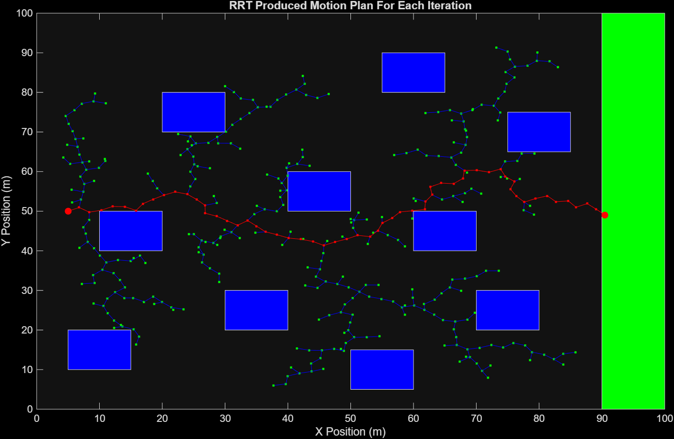
01
Developed a complete RRT-based path planning algorithm, including nearest-neighbor search, bounded expansion, and collision checking for both nodes and path segments .
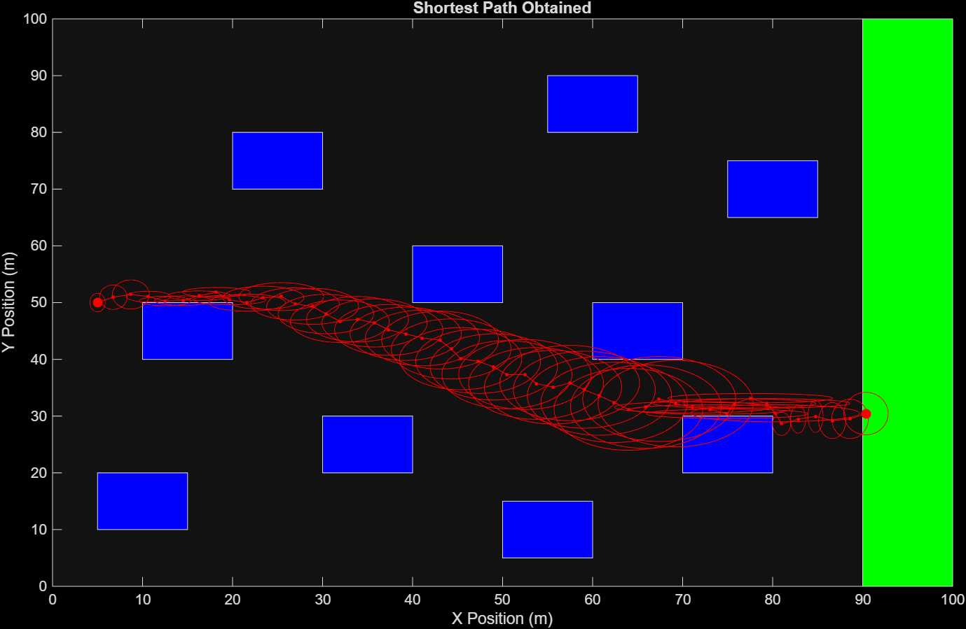
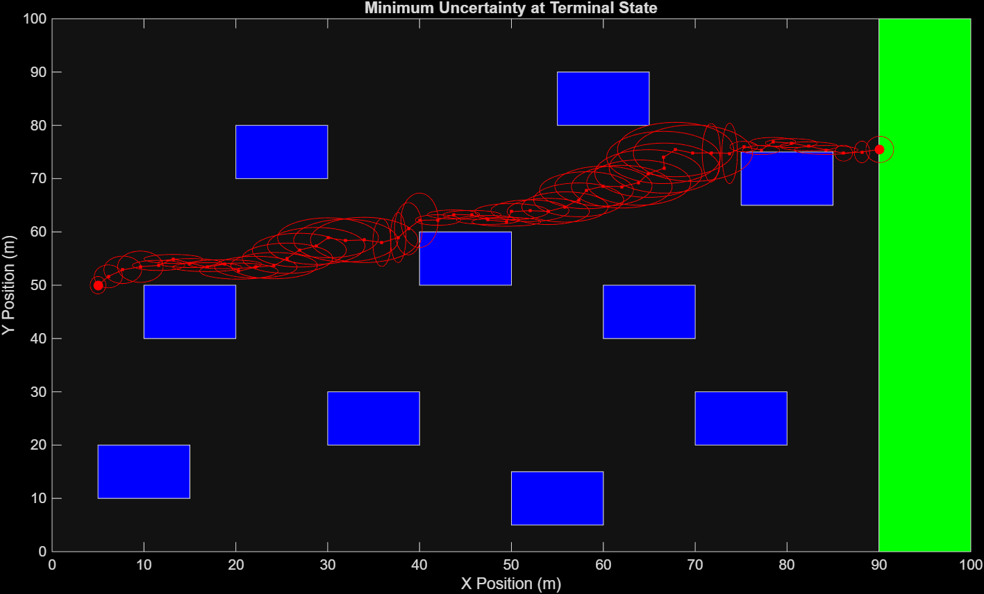
02
Implemented a Kalman Filter framework to propagate localization uncertainty along each trajectory using a state-space model.
03
Designed an adaptive sensing/measurement model that varies observability based on proximity to obstacles, linking environment geometry to estimation accuracy .
04
Ran large-scale simulations (20,000 paths) to analyze tradeoffs between path length, uncertainty, and collision risk, with visualization using uncertainty ellipses.
Visual Documentation
Figure 1
01.png
Example RRT motion plan which is unique to each iteration
Figure 2
02.png
Shortest path obtained after 20,000 iterations of the RRT algorithm. The ellipses were constructed based on projected localization uncertainty in the x and y directions.
Figure 3
03.png
Path with minimum uncertainty at the terminal state obtained after 20,000 iterations of the RRT algorithm. The ellipses were constructed based on projected localization uncertainty in the x and y dire
Path with minimum uncertainty at the terminal state obtained after 20,000 iterations of the RRT algorithm. The ellipses were constructed based on projected localization uncertainty in the x and y directions.